
The Royal River flows nearly 26 miles from its source in Sabbathday Lake in New Gloucester to its mouth in Casco Bay in Yarmouth. The watershed includes approximately 141 square miles of land in the towns of Auburn, Durham, Gray, New Gloucester, Pownal, North Yarmouth and Yarmouth. The Town of Yarmouth owns two dams, the Bridge Street Dam and the East Elm Street Dam. These are the lower-most dams in the watershed. Together they block access to over 100 miles of mainstem and tributary habitat for migratory fish. As part of the Royal River Restoration Project and following recommendations of the 2008 Royal River Corridor Master Plan, the Town of Yarmouth is evaluating options for fisheries and habitat restoration.
The 2008 Royal River Corridor Master Plan recommended performing a comprehensive study of the advantages and disadvantages of removing dams and recommended that improvements to fish passage be made throughout the river corridor:
“In terms of fish passage, the Lower Falls do not present a barrier to most fish species. Although the Upper Falls may themselves be a barrier, there is a side channel to the east of those falls that allows fish passage around the falls. In contrast, the two dams present a complete barrier to all fish passage. A concrete Denil fish passage exists at each dam, but these structures are flawed and do not appear to be providing adequate function.”
-Royal River Corridor Master Plan, 2008, p. 8.
Royal River Dams
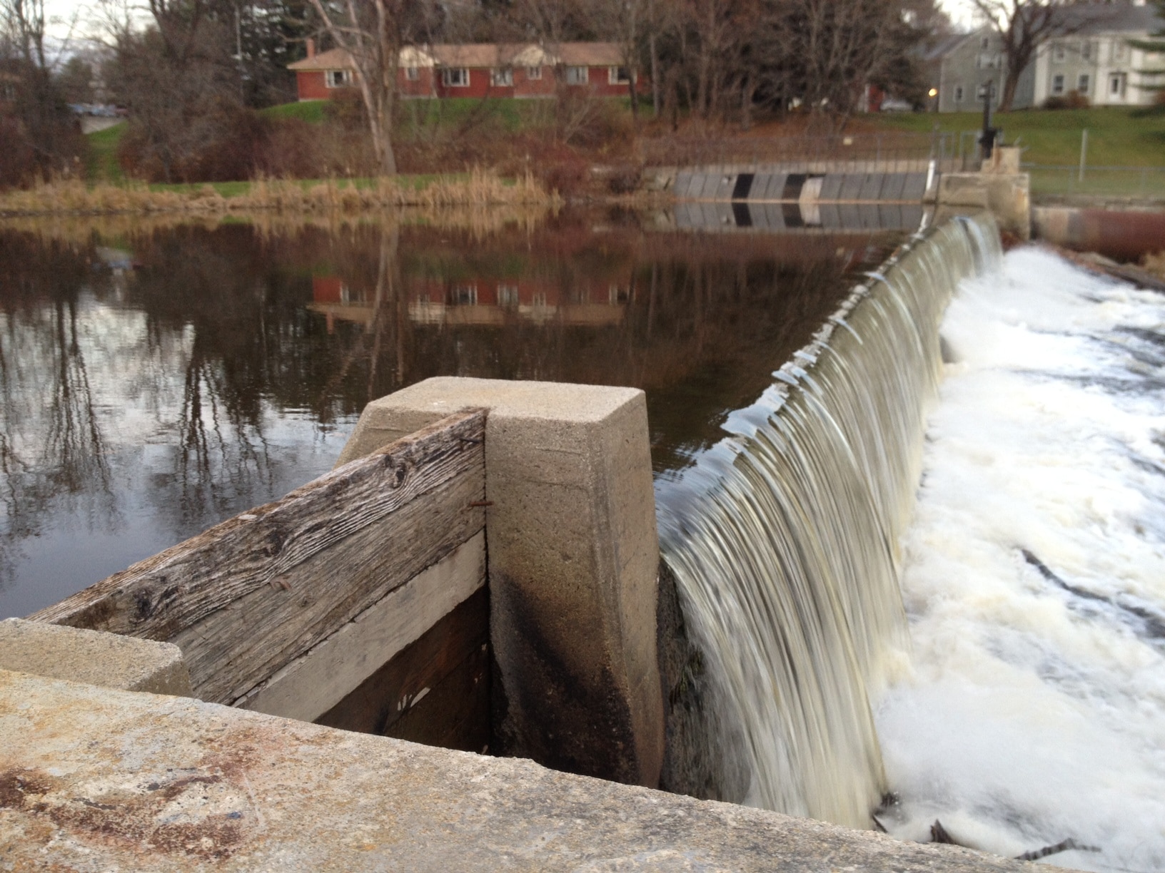
Bridge Street Dam
Structure
The Bridge Street Dam is made of reinforced concrete and is approximately 275 feet in length and 10 feet high. The hydropower turbines are located in the basement of the Sparhawk Mill, a penstock moves water from the Dam to the Sparhawk Mill where some is used for the hydropower operations.
Purpose
A hydroelectric generating facility at Sparhawk Mill uses water from Bridge Street Dam to produce small amounts of hydropower foruse by tenants of the Sparhawk Mill with limited amount sent to the power grid. The Town receives minimal if any revenue from the hydropower operation.
Owner
The Town of Yarmouth acquired the dam, right-of-way over adjoining property and flowage right in 1973. Flowage rights are limited to maintaining or lowering the existing water level.
Fish passage
Fish passage facilities were not part of the original dam configuration but were added in 1974. The Maine Department of Marine Resources maintains a lease from the Town to operate the fishway but the fishway has not been maintained and does not function. Funding from the Department of Marine Resources for repair or maintenance is severely limited.
Licensing
The hydropower operation holds an exemption from the Federal Energy Regulatory Commission (FERC) because it produces very little power. The FERC license is in the process of being surrendered.
East Elm Street Dam
Structure
The East Elm Street Dam is made of stone and is approximately 250 feet in length and is 12 feet high. It is an aging structure with visible evidence of deterioration.
Purpose
The East Elm Street Dam produces no power and there are no remaining industries associated with it. A mill was originally built in the vicinity of the dam in 1759 to power an iron refinery.
Owner
The Town of Yarmouth acquired the dam and flowage rights in 1971.
Fish passage
The Maine Department of Marine Resources maintains a lease from the Town to operate the fishway but the fishway languished for years without being maintained. It is not clear if the fishway has ever performed well. Funding from the Department of Marine Resources for repair or maintenance is severely limited.