
Undamming the Mousam River
The Mousam River watershed contains 349 miles of river and streams and drains a total area of about 117 square miles. It covers portions of the towns of Acton, Shapleigh, Waterboro, Sanford, Alfred, Lyman, and Kennebunk. The upper portions of the watershed are dominated by forests, wetlands, and agricultural lands. Development here is focused on the shorelines of numerous lakes and ponds, including Square Lake, Mousam Lake, Shaker Pond, and Bunganut Pond, and on the mainstem of the river as it passes through downtown Sanford. The mainstem meets the Littlefield River and the Middle Branch of the Mousam at Estes Lake, and from there the river flows toward downtown Kennebunk. Just below Route 1 in downtown Kennebunk, the river meets the head-of-tide and then flows through a rich estuary and tidal salt marshes, much of which is within the Rachel Carson National Wildlife Refuge. 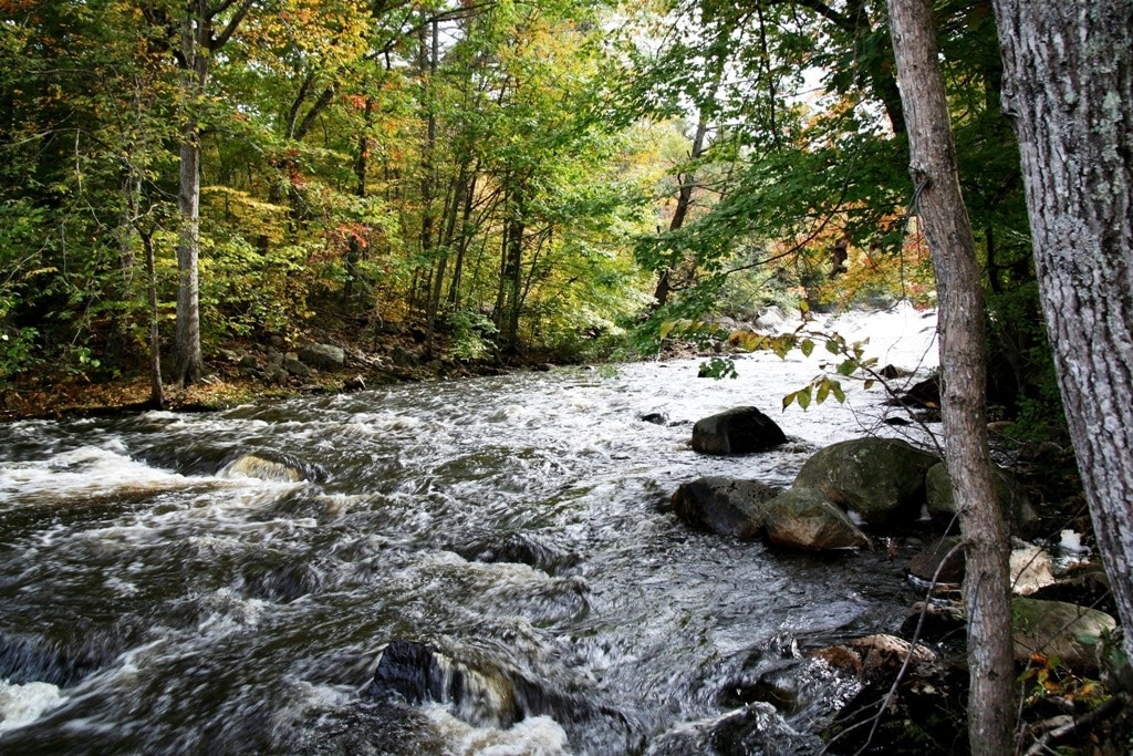
The Mousam watershed is a rich and diverse landscape with many areas considered to be of “statewide ecological significance” by the State of Maine. The Massabesic Forest, the Kennebunk Plains, and several others areas contain rare and exemplary natural communities that support a broad diversity of unique plants, animals, and wildlife. The Mousam River and its hundreds of miles of tributary streams once provided a seamless connection between these “upland” areas and the estuary and ocean, a link that existed for millennia and provided benefits to both the freshwater and marine environments. Species like American shad, alewives, blueback herring, American eel, and Atlantic salmon were historically present. The construction of dams on the Mousam broke this great natural cycle and caused the near loss of the river’s native sea-run fisheries and greatly impacted the fish and wildlife that depend upon them.
The health of the Mousam River has suffered tremendously due to a long history of degradation from pollution and dams. There are 15 known dams in the Mousam watershed, including 11 on the mainstem between the outlet of Mousam Lake in Shapleigh and the head-of-tide in Kennebunk, a stretch of river only 24 miles long. Maine Rivers remains focused on efforts to remove the three lowest dams in Kennebunk, dams that no longer produce power and lack any form of fish passage.
The lowermost three dams are owned by the Kennebunk Light and Power District (KLPD). These dams are up for relicensing by the Federal Energy Regulatory Commission (FERC). The KLPD Trustees have indicated that they would like to make a decision about whether or not they should seek a new license for the dams by the end of 2015, roughly 15 months before the FERC relicensing process will begin.
 The Mousam River is heavily impacted by the three KLPD dams and several others throughout the watershed. The Mousam is the only major river system in Maine completely lacking in fish passage. All of the river’s native anadromous fish species are relegated to a very small stretch of freshwater habitat below the first dam in downtown Kennebunk. There are nearly 350 miles of freshwater rivers and streams in the Mousam watershed, but only 1% of that stream network is connected to the ocean and accessible to species like American shad, Atlantic salmon, alewives and blueback herring.
Removing KLPD’s dams will restore more than 9 miles of the mainstem Mousam and another 6 miles of high-quality tributary habitat. This will greatly benefit the river’s three species of river herring and will also restore a vast amount of habitat for brook trout that is currently unsuitable.
The next few years mark the first opportunity in nearly 40 years to make fundamental changes to the Mousam River – and it could be our last opportunity for another 40 years. The Mousam has suffered from more than 300 years of dams. It is time to change course and begin the process of restoring this phenomenal river system.
Mousam and Kennebunk Rivers Alliance Formed
The Mousam and Kennebunk Rivers Alliance has been formed by local volunteers with support from Maine Rivers and the Wells Reserve. One goal of the newly formed Alliance is to begin work to update the fisheries restoration and management plan for the Mousam River; the existing plan dates back to 1955. Projects are underway to do water quality testing on the Mousam River, assess habitat quality along the waterways, survey fish communities, and coordinate information about projects in the watersheds. For more information, contact Landis: landis@mainerivers.org or to volunteer: Jacob.
In the News
Dams divide, questions deepen
River studies underscore poor water quality
The dam question
Mousam River dams at a turning point
Portland Press Herald Online, 7/22/13
Local alliance puts alewives back in Alewife Pond
Alewives; the hidden resource in our waters Seacoast On-line, 6/2/11
Residents Welcome to Join Intervale Park Planning Process
New Alliance Gets Grant to Study Local Rivers
Repairing Our Rivers
Study Tracks Fish in the Mousam Rivers Estuary
May 29, 2009 Maine Rivers Conference on the Mousam and Kennebunk Watersheds